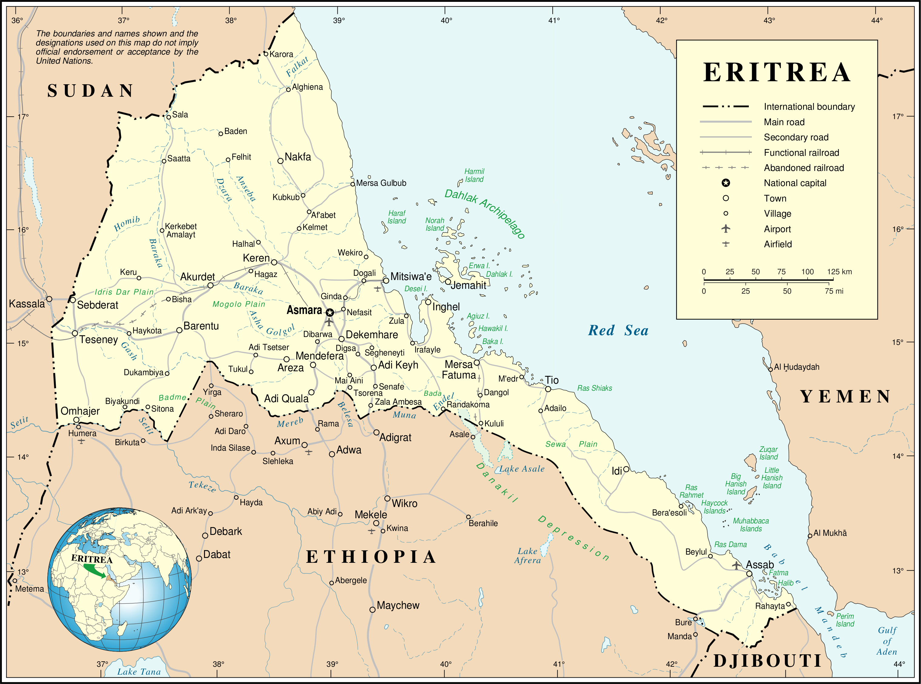
Tiedosto:Un-eritrea.png
Alkuperäinen tiedosto (3 038 × 2 257 kuvapistettä, 1,26 MiB, MIME-tyyppi: image/png)
| Tämä tiedosto on tiedostotietokanta Wikimedia Commonsista. Tiedot kuvaussivulta näkyvät alla. |  |
Tiedoston kuvaussivu Commonsissa |

|
Tämä tyyppiä map oleva kuva pitäisi luoda uudelleen SVG-tiedostoksi vektorigrafiikan avulla. Tällä tiedostotyypillä on monia vahvuuksia, sivulta Commons:Media for cleanup löytyy lisätietoja. Jos tästä kuvasta on jo olemassa SVG-versio, ole ystävällinen ja tallenna se tänne. SVG-tiedoston tallentamisen jälkeen vaihda tämä malline mallineeseen {{vector version available|uusi kuvan nimi.svg}}.
|
| This image is a map derived from a United Nations map.
Unless stated otherwise, UN maps are to be considered in the public domain. This applies worldwide. UN maps are, in principle, open source material and you can use them in your work or for making your own map. UN requests however that you delete the UN name, logo and reference number upon any modification to the map. Content of your map will be your responsibility. You can state in your publication, if you wish, something like: based on UN map … (map name, map number, revision number and date). See: Geospatial Information Section. And: Geospatial, location data for a better world. |
 |
Tiedoston historia
Päiväystä napsauttamalla näet, millainen tiedosto oli kyseisellä hetkellä.
| Päiväys | Pienoiskuva | Koko | Käyttäjä | Kommentti | |
|---|---|---|---|---|---|
| nykyinen | 24. lokakuuta 2007 kello 03.57 | | 3 038 × 2 257 (1,26 MiB) | Jeroen | {{UN map}} Category:Maps of Eritrea |
Tiedoston käyttö
Seuraava sivu käyttää tätä tiedostoa:
Tiedoston järjestelmänlaajuinen käyttö
Seuraavat muut wikit käyttävät tätä tiedostoa:
- Käyttö kohteessa ar.wikipedia.org
- Käyttö kohteessa avk.wikipedia.org
- Käyttö kohteessa az.wikipedia.org
- Käyttö kohteessa be.wikipedia.org
- Käyttö kohteessa ca.wikipedia.org
- Käyttö kohteessa ckb.wikipedia.org
- Käyttö kohteessa cs.wikipedia.org
- Käyttö kohteessa de.wikipedia.org
- Käyttö kohteessa en.wikipedia.org
- Käyttö kohteessa en.wiktionary.org
- Käyttö kohteessa es.wikipedia.org
- Käyttö kohteessa fa.wikipedia.org
- Käyttö kohteessa fr.wikipedia.org
- Käyttö kohteessa ig.wikipedia.org
- Käyttö kohteessa it.wikipedia.org
- Käyttö kohteessa ja.wikipedia.org
- Käyttö kohteessa ka.wikipedia.org
- Käyttö kohteessa mzn.wikipedia.org
- Käyttö kohteessa nl.wikipedia.org
- Käyttö kohteessa no.wikipedia.org
- Käyttö kohteessa pa.wikipedia.org
- Käyttö kohteessa pl.wikipedia.org
- Käyttö kohteessa pl.wiktionary.org
Näytä lisää tämän tiedoston järjestelmänlaajuista käyttöä.